

March 15-16, 2024
At this point in our LA Exodus journey, we still like each other! Of course some days are better than others, but we roll through challenges. We adapt. We laugh. We grow.
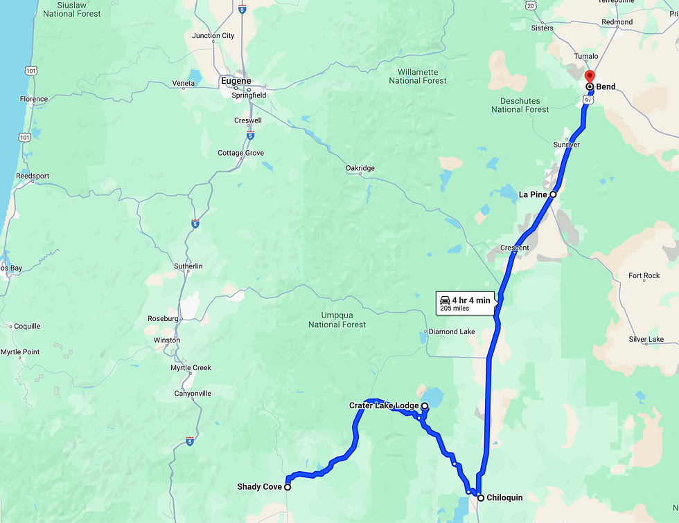
Traveling from Shady Cove to Bend (via Crater Lake) was one of the best and longest days we've experienced to date. We were curt-eously warned when we left Shady Cove that it might not be possible to get up to the rim of Crater Lake. Being Trish and Joel though, we thought we'd give it a shot anyway!
Molly's Mom Linda (who suggested we stop at Shady Cove) also recommended Prospect, OR - because of its beauty, and to visit the forever-loved Beckie's Cafe. We gratefully accepted her advice and let it be the guide for our drive to Crater. Another cool thing about this type of 'follow our gut' travel is having the ability to be flexible and to spot/listen for opportunities or suggestions that help lead the way...
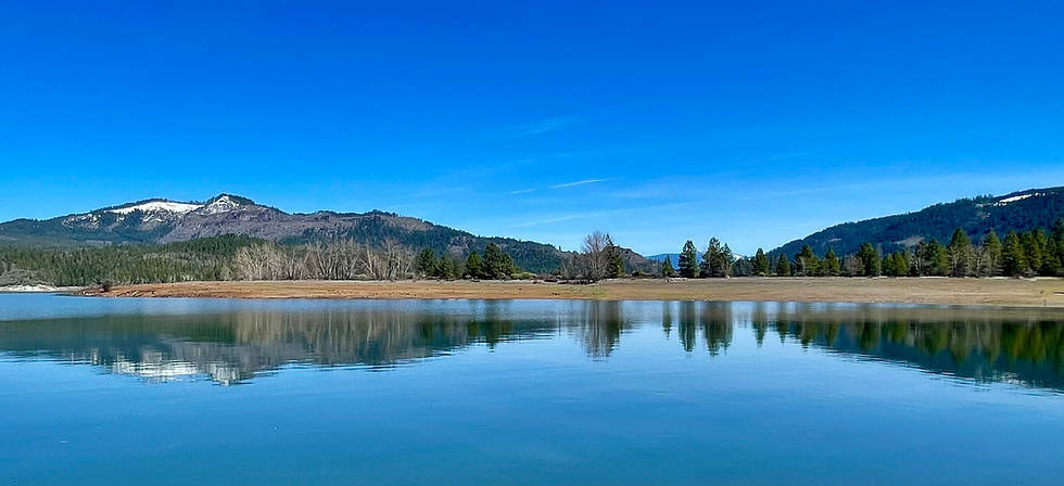
The first town outside of Shady Cove along the 62 is Trail. Man...are we glad we didn't zoom past this little gem! We noticed a beautiful lake as we were driving and naturally pulled over to check it out. We looked at each other and within ten minutes we were parked at the MUST STOP SPOT! (say that 10 times) Joseph H. Stewart State Recreation Area to view Lost Creek Lake. Oh my. We did not expect to spend an hour here - it just happened. What an unexpected treat!
Notes:
The Joseph Stuart Recreation Area is located in Jackson County - approximately 40 miles from Crater Lake National Park on the Rogue River. It offers amenities for day use ($4 parking at this spot), boating, fishing, camping, etc.
Lost Creek Lake is actually a reservoir on the Rogue River in Jackson County, OR - it was constructed by the U.S. Army Corps of Engineers for flood control and fisheries enhancement in 1977.


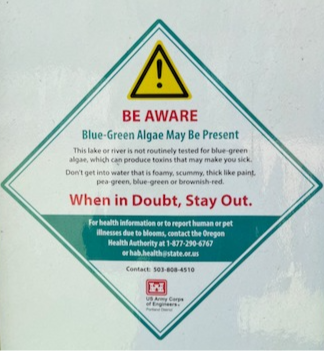
We found a 20-acre property for sale nearby...the huge front gate was a little foreboding, but the multiple 'No Trespassing' signs encouraged us to call the realtor. Turns out the listing was no longer active. It's okay though...we did spot relatively large skeletal remains walking back to Max. And, given the water level of this reservoir was still very low (of course a concern even with the winter) plus the various toxic algae bloom sign warnings...we moved on.


We continued driving Route 62 to...Prospect (also on the Rogue River). Another MUST STOP SPOT! As if the first pullover on this day wasn't awesome enough, we get here to discover a quaint, very small town full of fun wonders! Breathtaking views, the magnificent Rogue River - Siskiyou National Forest, insane waterfalls, and snow...what could be better?!
Prospect is on the edge of the Cascade Mountains - it began as a logging town with the first saw mill operating in 1870. In 1892, the Historic Prospect Hotel first opened and ever since, visitors have been stunned by these incredible natural attractions! It's that kind of place where you can actually still find a payphone!
Never-ending WOW moments on this portion of the drive. Please plan to get out of your car and throw on walking shoes for this stretch...


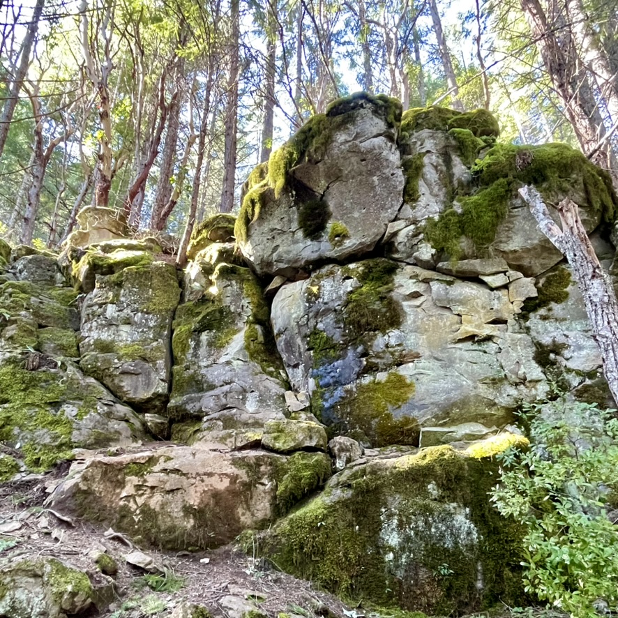
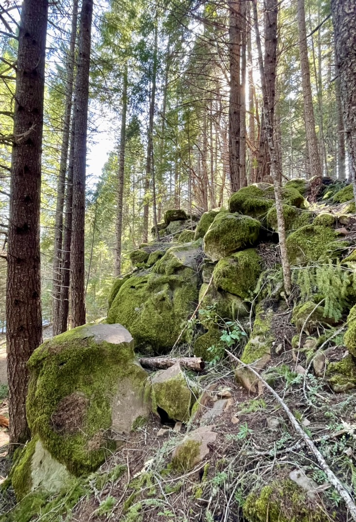
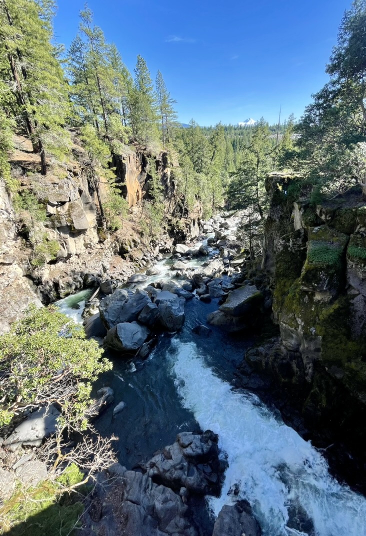
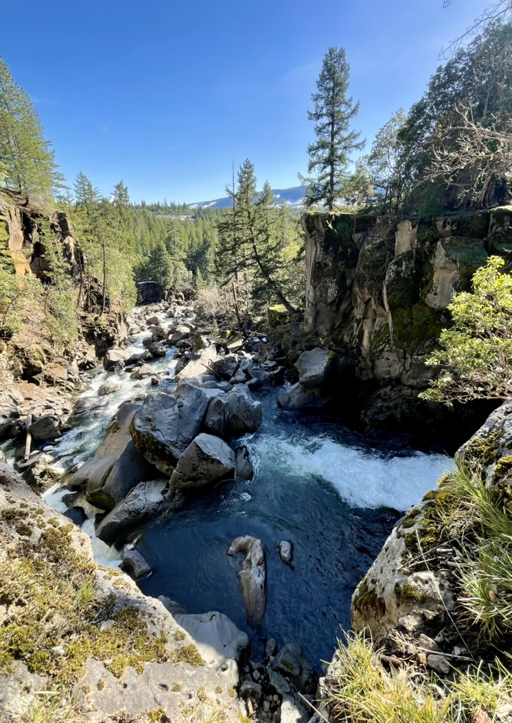
Another MUST STOP SPOT! is the AMAZING Prospect State Scenic Viewpoint along the Rogue River (formerly known as Mill Creek Falls Scenic Area), to see the 173 ft Mill Creek Falls and 240 ft Barr Creek Falls (not pictured).

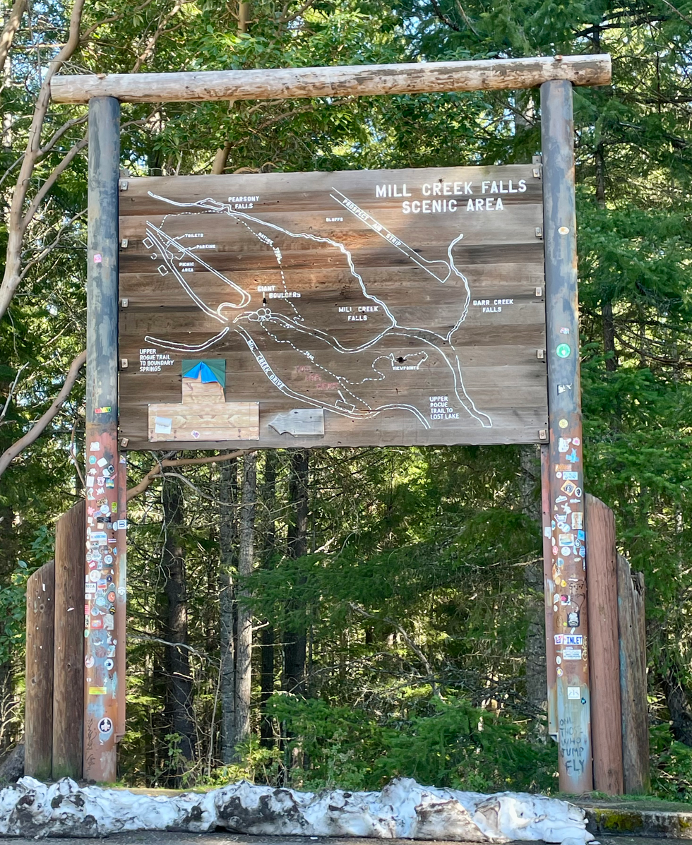

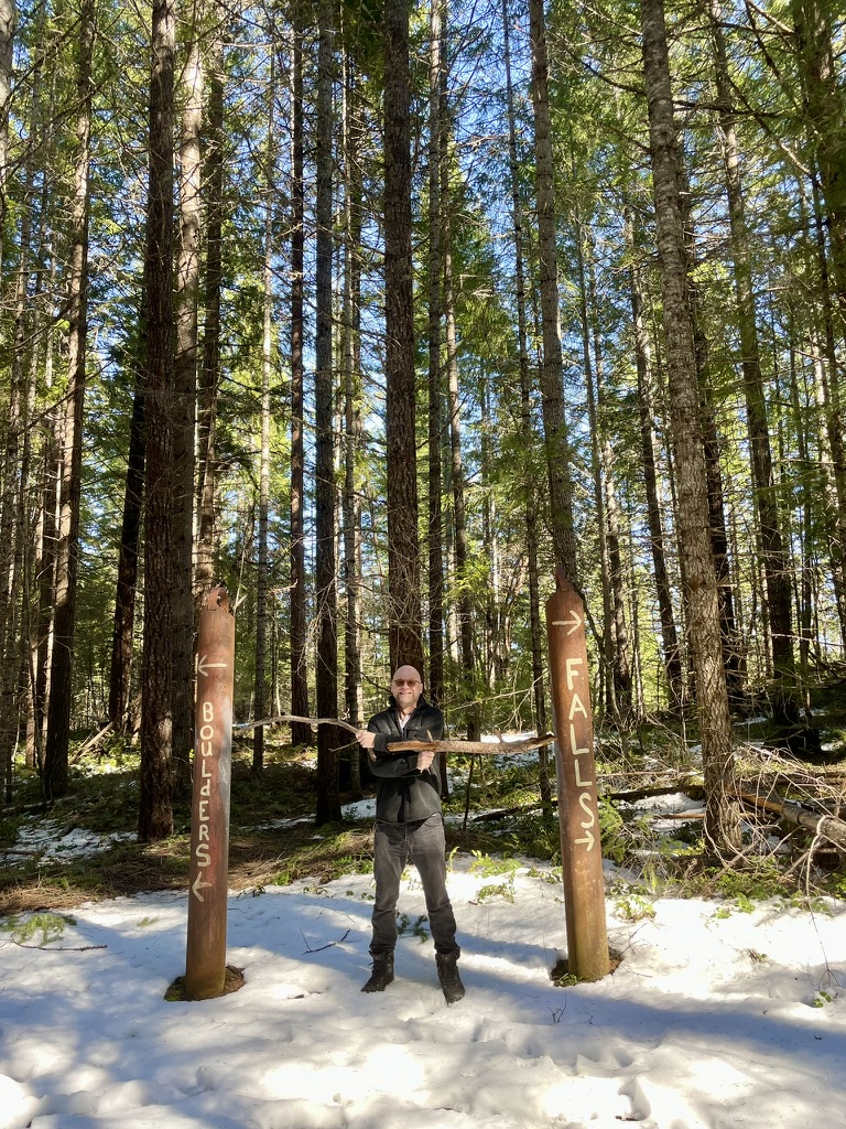


Here's the video of Mill Creek Falls...we chose not to take any steps close - there's a giant cliff/ravine between us and the water - easily 100 ft fall! The trees you see are growing up from our side of the cliff...
The following are views from the bridge over the Rogue at the Avenue of the Boulders (you can see Mt. Thielsen in the distance)...standing at any of these places truly reminds us of just how beautiful our natural world (and specifically, America) is - peaceful, silent, wild, crazy, forgiving, resilient in its best moments.


We were hungry at this point - Beckie's Cafe beckoned! It's a small, log cabin restaurant - a local homemade comfort food establishment that has seen it's share of tourists, locals and much, much more. When you enter, you're instantly transported to a bygone era. Decor, vibe, everything. Great service! and what you would expect kind of food. We shared the tuna melt and big, doughy and greasy pretzels that come at you like swords - served with a gooey, spicy, cheesy sauce. Joel had to order the chili. Of course. (It's a funny thing I've learned about him after 16 years that I never knew). Beckie's is known for its pies, so of course we had to order the special of the day to go (very blueberry)...only it never made it out the doors. FYI - they also offer enormous cinnamon rolls. We kept our dignity in check and left with full stomachs and empty hands.


Full of lunch and blueberry pie, we headed to Crater Lake. We figured we'd just drive on from there if we couldn't get to the rim - if nothing else, we'd take in a load of fresh air and see copious amounts of magnificent snow-lined trees!


We drove though what was a pretty nerve racking segment in Max - passing through a walled corridor of snow along either side of the road, with the snow even exceeding the height of Max (he's 11.5' tall!). Some parts of the road narrowed to a harrowing single lane - fortunately, the few cars coming the other way did so while there were two lanes.


It was absolutely beautiful and we embraced the rare opportunity to view all of it like this, given the unusually rough winter here this year. We came upon the almost completely buried Crater Lake / Munson Valley Road crossroad sign + the Road to Rim is Closed notice and switched gears...heading instead towards Bend (via a detoured route 62 south to Klamath Falls, then up to Bend to via route 97.


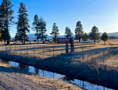
We passed Fort Klamath - saw a few legit teepees and drove through the downtrodden town of Chiloquin.


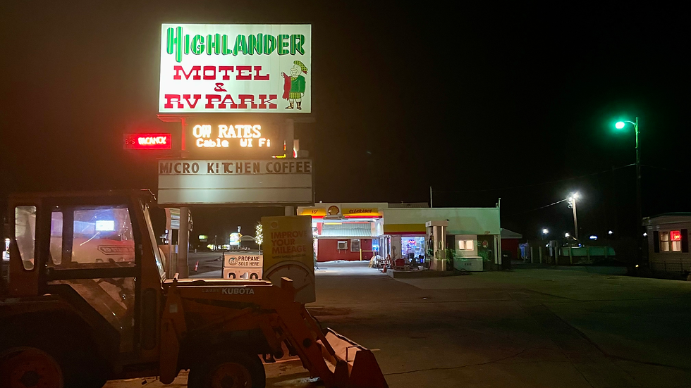
Sunset disappeared and we kept rolling into darkness...for what seemed like forever. It was dark and we were a bit cranky (especially after chugging Max through a horribly paved, less than desirable permanent RV Mobile home park - will not mention it here), so we finally stopped at the sexy Highlander RV Park/motel/gas station in La Pine - a city 30 miles south of Bend. Brian (owner) was super welcoming and showed us to our concrete back-lot rest stop. It was not on anyone's first choice list of pretty RV parks (mostly packed with run down, permanent mobile homes) - but in all fairness, it ended up being a really easy & convenient drive thru space with access to all of the appropriate hookups/amenities - including sewer...and QUIET!
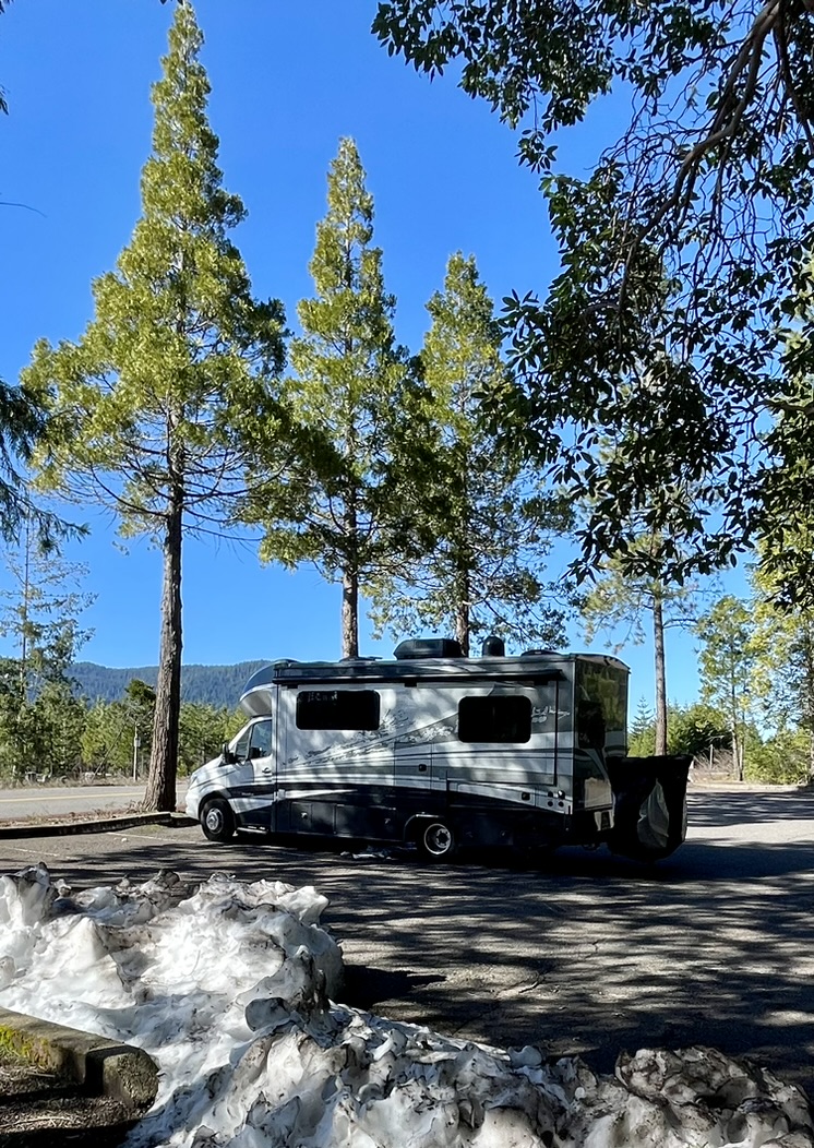
We got an unusually early start the following morning - wanting to explore La Pine (as long as we were there) - we decided to veer off the highway four miles to check out LaPine State Park.


Whoa! MUST STOP SPOT! It's beauty lies along the trout-filled Upper Deschutes River in a high desert sub-alpine forest. With over 14 miles of multi-use trails that follow both sides of the river, there's a ton to do here - everything from hiking and mountain biking to fishing, boating, swimming, and camping.


The view out the window as we drove though the LaPine State Park. This seemed to go on for miles... Go full screen!
Discovering this amazing place was one of the most unexpected happy moments for both of us. The La Pine State Park was closed, but not for entry so we had virtually the entire snow-laden forest to ourselves! It was totally unreal. In this hour+ visit, we saw only a handful of cars. I cannot imagine how many tourists this jewel sees when it's open, but we were grateful to experience the glorious fresh air, winter silence and utter breathtaking scenery.
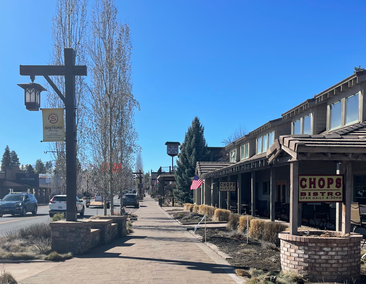
Then we arrived in Bend. I cannot for the life of me understand the "you gotta go to Bend" hype. Seriously. Hoping someone can explain because after driving around the entire town (including a handful of its outlying neighborhoods)...Joel and I were expecting something compleeetely different. We believe there are nice places 10-50 minutes drive to town. And no offense to any Bend loyalists, but we were literally so underwhelmed that we decided not to follow our original plan to stay for a few days. Totally understand wanting to bike and hike the surrounding mountainous areas...but, it is the high desert and Bend itself was not very charming and a lot browner than we imagined (even in winter).
The town is also where everyone goes to run everyday errands. There were people and cars everywhere in Brandis Square - too many for such a small downtown space (especially on an early Friday afternoon). The roadabouts do not operate like they do in Europe where there's an outside lane to see who's actually turning...and, there's construction happening everywhere (which signifies even more growth and people). No thanks. This is why we moved out of LA.


Sisters (next town)...same thing, but to a lesser degree:


We kept rollin on - loved the gorgeous, green tree-laden drive on Route 20 (AKA Santiam Hwy) to Route 34 - through the Willamette National Forest and along the S. Santiam River (oddly, there are not as many opportunities to pull off for pics on this beautiful path - just a note in case you ever take it).
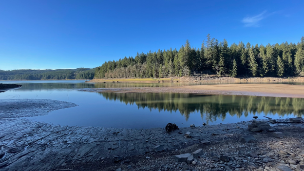
We passed the towns of Foster (just east of Sweet Home), Sweet Home and Lebanon. We jumped out and spent a little time at Calkins Park & the Foster Reservoir - which despite the recent heavy winter rains, has a shockingly low agua level - several feet lower than the end of the boat launch ramp. It's approximately 3.5 miles long and aside from its dam duties, it also serves as a popular recreation spot in this area. Really pleasant, colorful viewing place if you have the opportunity or time to check it out. MUST STOP SPOT!


Won't mention any names, but there are an awful lot of unusually hoardy folk livin' on the outskirts of Eugene. Notable.
After driving many miles by countless small and large farms and supporting businesses, Max finally cruised the into the lovely college town of Corvallis close to sunset...
On to Corvalis & Eugene OR
Comments